The Coachella Valley, one of the better places on the planet to live (in my humble opinion), makes up a large portion of the Colorado Desert, which is named after the river that is its eastern boundary. Although the Colorado Desert runs quite a way down into Mexico, the Coachella Valley is bordered by several distinct mountain ranges mostly in Riverside County and I have heard all of them referred to as the “Chocolate Mountains”
The bad news is that none of the mountains you see surrounding us are the Chocolate Mountains. The good news is that there really is a range called the Chocolate Mountains but they are mostly in Imperial County and aren’t really visible from north of the Salton Sea. The Chocolate Mountains are actually used by the Navy and Marines as an aerial and gunnery practice range and definitely off limits to people. They are east of the southern end of the Salton Sea.
The mountains most commonly referred to as the “chocolate mountains” are the mountains to our north. The same mountains that the afternoon sun paints so beautifully, are actually the “Little San Bernardino Mountains” that run east along the north side of I-10.
The Mountains that you see to our east and south of I-10 at called the Chuckwalla Mountains and they run south to the north end of the Chocolate Mountains. There aren’t any noteworthy ranges to the south of the Chocolates.
The western side of our valley is bordered by the San Jacinto mountain range. The most prominent mountain is named Mount San Jacinto and is 10,834 feet tall. It is on the south side of the San Gorgonio pass (I-10) and is snow covered most of the winter. The Palm Springs Aerial Tramway runs up the side of Mount San Jacinto to the 8,500-foot level. The San Jacinto Mountains are a relatively compact but tall range. On the north side of I-10 / San Gorgonio Pass is the tallest peak in southern California (7th tallest in the lower 48). Mount San Gorgonio (snow covered longer than Mt San Jacinto) makes up the eastern end of the San Bernardino Mountains and rises 11,499 feet above sea level.
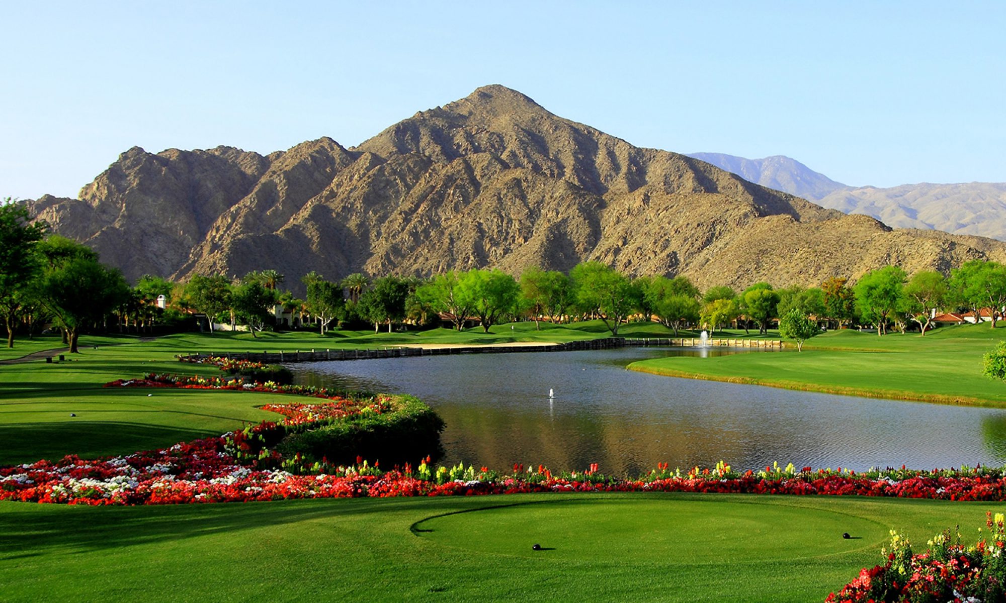
The smaller Santa Rosa Mountains run from just south east of Mount San Jacinto (near Rancho Mirage – Palm Desert area) in a southeasterly direction to roughly the north end of the Salton Sea (just south of La Quinta). These are the mountains you see looking south beyond PGA WEST.
So, remember, you can’t really see the Chocolate Mountains from here and the San Bernardino and Little San Bernardino mountains are two distinct ranges and along with the San Gabriel range and others to their west are the only ranges in North America that run East – West but that is another story…